
Sawback Trail Hike: Johnston Creek to Baker Lake
14 min read
Table of Contents
In the winter before Parks Canada backcountry reservations opened, I poured over my topo maps looking for a backcountry trip in Banff National Park I hadn’t done that looked interesting. I ended up choosing a four-day variation of the Sawback Trail hike that started at the Moose Meadows parking lot (near Johnston Canyon) and took us up Johnston Creek Valley, Pusatilla Pass, Baker Lake, and finished at the bottom of the fire road near the Lake Louise Ski Area. It turned out to be a tough hike with long days and enough elevation gain to give you quite a workout.
On the upside, we discovered some beautiful country on the Sawback Trail that few people see, especially in the area between Luellen Lake, Badger Pass and Pusatilla Pass. It’s grand, empty – and sometimes desolate feeling. As a bonus the campsites are excellent at Luellen Lake and Badger Pass Junction, especially compared to the not-so-private mud holes that are called campsites at Baker Lake Campground.
The full Sawback Trail hike starts at the Mount Norquay day lodge and finishes about 73 km later at the Fish Creek Parking Area near Lake Louise. However, everything I had read about the first section of trail sounded less than interesting. Think lack of views and lots of trees, similar to what I saw on my hike to Cascade Amphitheatre – which covers the beginning of the trail. I’m sure Mystic Lake and Mystic Pass are beautiful, but there’s a lot of kilometres to hike to see them.
This post includes some affiliate links. If you make a qualifying purchase through one of these links, I will receive a small percentage of the sale at no extra cost to you. Thank you very much for your support.

Sawback Trail hike summary
Total distance for our version of the Sawback Trail: 62.6 km (38.9 miles) though Judy’s app read about 69 km.
Approximate elevation gain/loss: +2,254 m (7,396 feet)/-1,828 m (5,997 feet)
Level of difficulty: Hard
Time needed: Four days was good for this distance.
Best time to hike: Late June until the snow flies, usually sometime in September.
What to take: You’ll need a backcountry reservation for all campsites and a national parks pass to hike the trail
Backcountry campsites on the part of Sawback Trail we did: Jo9 (Larry’s Camp), Jo18 (Johnston Creek), Jo19 (Luellen Lake), Jo29 (Badger Pass Junction), Ba15 (Wildflower Creek), Ba11 (Baker Lake), Sk5 (Hidden Lake)
Concerns: The Sawback Trail traverses prime grizzly country, so take easy to access bear spray and know how to use it. Porcupines love salt and will chew your hiking poles and hiking boots if accessible.
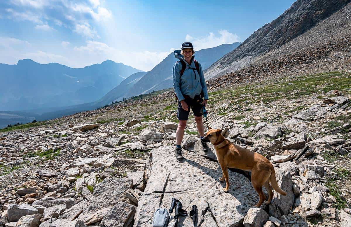
Dogs: Permitted on a leash.
Don’t forget: Be sure to pack the hiking essentials and leave a plan of where you’re do out with someone. Try to leave the campsites cleaner than you found them. We saw almost no garbage on the trail, save for the odd errant bar wrapper.

Finding the trailhead for the Sawback Trail hike
We did a version of the Sawback Trail hike using two cars. We left one at our finish – the Fish Creek parking area – off the road to Lake Louise Ski Area and another at Moose Meadows on Highway 1A where we started.
Fish Creek Parking Area
Turn north off the Trans-Canada Highway and continue on Whitehorn Road towards the Lake Louise Ski Area for 2 km, passing the turnoff to Highway 1A along the way. Take the right onto a dirt road – signed for Skoki Lodge. There’s a decent sized parking lot and a couple of porta pottys too.
Moose Meadows parking
From Castle Junction on Highway 1A (where you can get gas, snacks, and cold drinks) drive 4.9 km southeast to reach the signed turnoff to Moose Meadows. If you’re driving Highway 1A west from Banff, you’ll find the Moose Meadows parking lot, 1.2 km northwest of the Johnston Canyon parking area.
Day 1 on the Sawback Trail: Moose Meadows Parking lot to Luellen Lake
Distance: 17.1 km or 10.6 miles.
Time moving: 5:23 hours
Elevation gain/loss: +708m/-149m
Destination: Luellen Lake Campground
The hike on the Sawback Trail rom Moose Meadows to Luellen Lake is straightforward. The 5.3 km trail to the Ink Pots is signed and well used after it meets up with the trail coming up from Johnston Canyon. (You could start at Johnston Canyon, but parking is always an issue here, so I think it’s more considerate to free up a space for four days and park at Moose Meadows instead.)
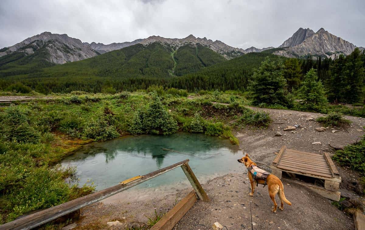
From the Ink Pots head across the meadows on an obvious trail to reach a bridge over Johnston Creek. Go up the trail about 50 m to reach the Johnston Creek Trail. Turn left and follow the trail to reach Larry’s Camp in the trees beside a creek at 7.6 km. Cross the creek and go left to continue towards Luellen Lake. Going right takes you to Mystic Pass.
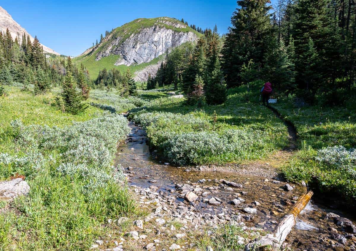
Continue for another 8.5 km on the Sawback Trail through a mix of meadow and forest, climbing gradually to reach a wide-open area and a sign pointing left or west towards Luellen Lake. We were worried we’d missed it as this section felt long but we didn’t, and you won’t. Cross Johnston Creek again and climb gently for about 15 minutes to reach peaceful Luellen Lake and the campground.
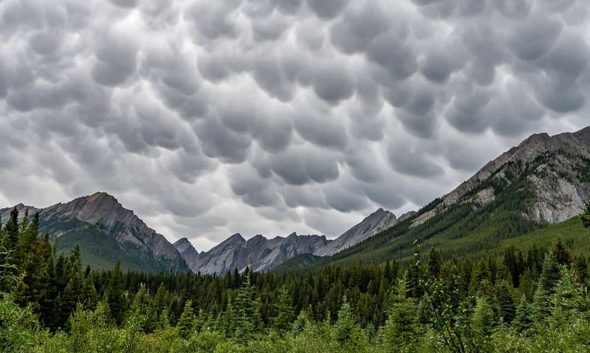
A highlight for us on this section was seeing Mammatus clouds about 20 minutes after leaving the Ink Pots – an indicator of possible heavy rain, hail, and lightning – all of which some people we met on the trail the next day experienced in the evening.


The Luellen Lake Campground in Banff National Park
Long, narrow Luellen Lake is in a pretty setting below the Helena Ridge cliffs. We saw a family of grebes on the lake in the evening and again in the morning.
I really liked the Luellen Lake Campground. There were five private tent sites, a privy a long distance from anything, bear lockers, a picnic table, benches, and a fire ring. As you can see, it was easy to get water from the lake – and there was an pretty outlet stream just a short distance away.


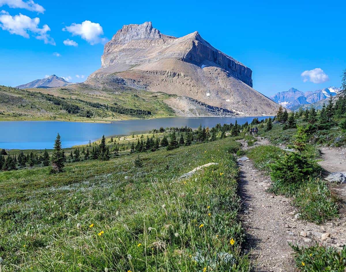
Day 2 on the Sawback Trail: Luellen Lake to Badger Pass Junction
Total distance: Approximately 16 km from Luellen Lake to the Badger Pass Junction Campground – and then an out and back to within a kilometre of Badger Pass.
Distance one way to Badger Pass from the Johnston Creek Trail: 5.0 km
Time moving: 3:57 hours.
Elevation gain and loss: +578m/-376m
The 6.3 km hike on the Sawback Trail from Luellen Lake to Badger Pass Junction Campground is an easy one that you can knock off in under two hours.
Retrace your steps to the intersection you left the day before. Turn left and continue on the Sawback Trail as it heads northwest up the valley. It gets prettier as you go with the Sawback Range coming into view.
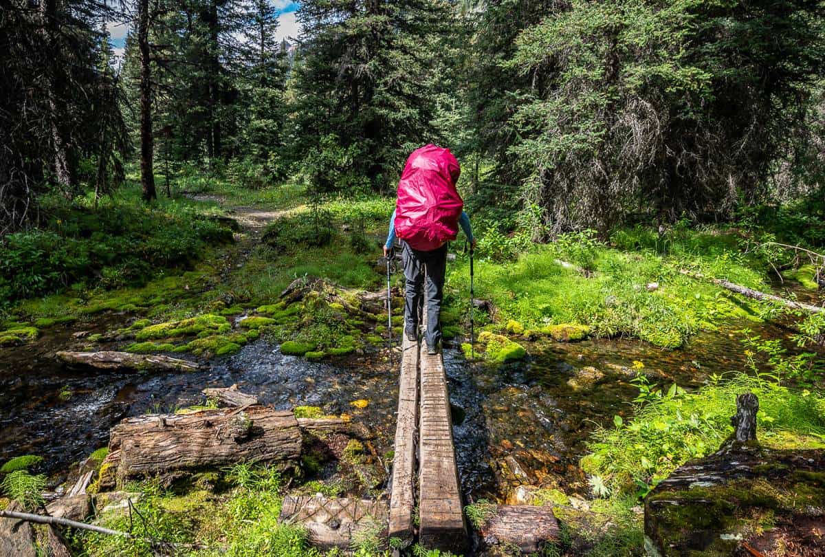
There is one stream you’ll have to ford on the way to the campground – and there are a lot of chest high willows to get through. You’ll reach the turnoff to Badger Pass about 0.5 km before you reach the campground. We elected to head to the campground, set up our tent, drop our food – and then retrace our steps to the turnoff to Badger Pass and do it as a day hike.
To get the the Badger Pass Junction Campground, rock hop across a stream, head up the hill and start looking for campsites. I found a very private one with a fantastic mountain view.


Day hike to Badger Pass from Badger Pass Junction
After our lunch my friend Judy and I rustled up some enthusiasm to hike to Badger Pass. We both agreed we only needed to go a short distance up – but the more we hiked, the more we both wanted to see.
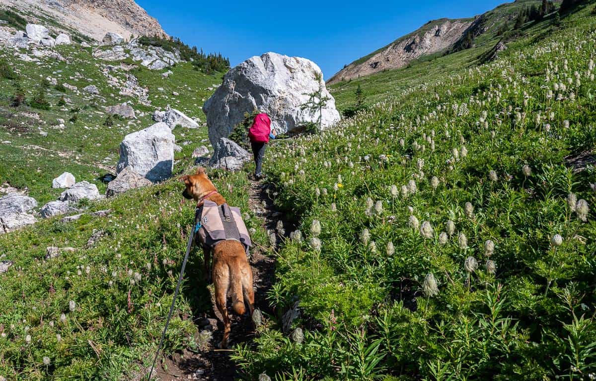
You must backtrack 0.5 km from the campground to reach the trail up to Badger Pass. There’s immediately a short section of steep hiking but part way up there’s a view of a stepped waterfall. The photo below doesn’t do it justice. Shortly after, we topped out in some pretty meadows that were loaded with potentilla (shrubby cinquefoil) – the yellow flowering hardy shrub.
To get to Badger Pass you must ford several streams. Some were a snap, but if you wanted to keep your feet wet, others took some scouting.
It’s a steady 519 m (1,703 feet) gain to Badger Pass, but a moderate one with lots of meadows, flowers and some gorgeous views as you get out of the trees. On the other side of Badger Pass there are two campgrounds – Block Lakes Junction – 7 km distant and Flint’s Park, 12.5 km away. You can hook up with the Mystic Pass trail if you take this route.


Day 3 on the Sawback Trail: Badger Pass Junction to Pusatilla Pass to Baker Lake Campground
Distance: Approximately 16.4 km though Judy’s app read as 20.5 km.
Time spent moving: 5:35 h
Elevation gain/loss: +828 m/-603m
Destination: Baker Lake Campground
The hike to Baker Lake Campground from Badger Pass Junction on the Sawback Trail was basically half fantastic (the part to Pusatilla Lake) and half not so much fun.
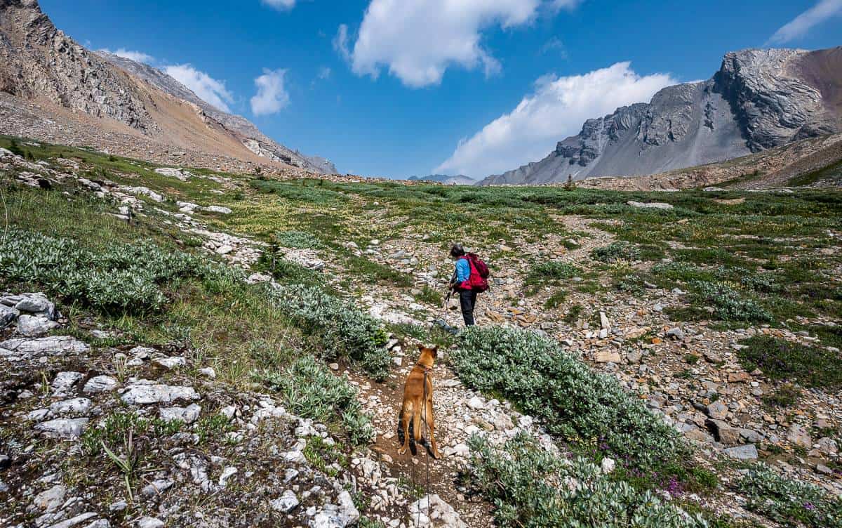
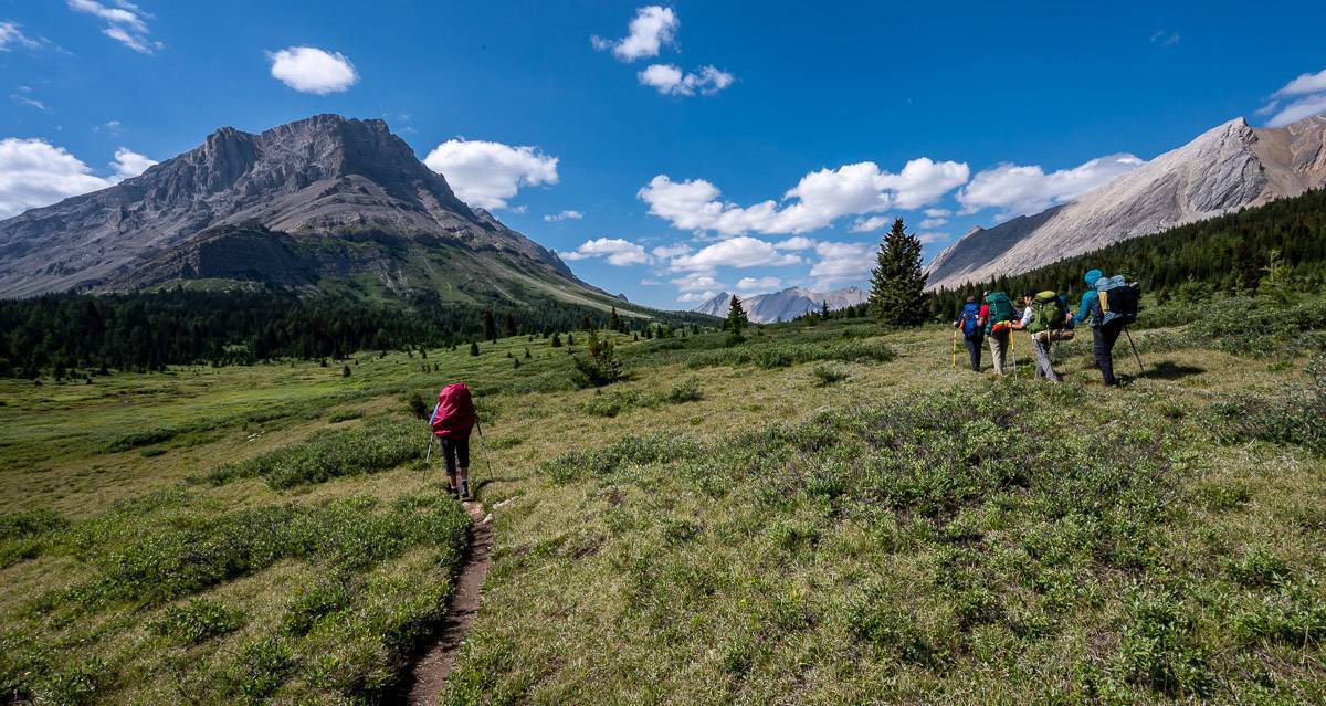
You start by fording a stream immediately after leaving the campground. Continue walking northwest, through willows at times, for 3.9 km with to reach Pusatilla Pass. It’s a beauty – and Pusatilla Lake is a place where you just want to drop your pack and relax. We did not, but we did stop for an early lunch to take in the views before plunging steeply down into the trees for 6.4 km to reach the Wildflower Creek Campground at the junction with the Baker Creek Trail. In places there were lots of trees down, but nothing that was difficult to get around.
The next 5.3 km on the Sawback Trail weren’t a lot of fun – lots of water, soggy ground, avalanche paths with debris, flash-flood rubble at Lychnis Creek – and then a steep 1 km section that delivers you in a subalpine meadow. Once at the meadow, the hiking was good again – and provided sweeping views up the valley. We had a nice conversation with four young guys from Toronto (their party of seven dwindled to four after the first night of thunderstorms and lightning) before turning left or northwest to hike 0.8 km to the Baker Lake Campground.


Baker Lake Campground
I visited Baker Lake Campground 10 years ago and nothing has been upgraded, in that time, save for the outhouses. I love the hiking you can do out of Baker Lake, including the Skoki Loop, but I don’t like the lack of privacy, the dirt only tent pads, and hanging food such a long distance away.
On the bright side, Baker Lake is very beautiful, especially in the morning when it’s quiet. We had a deer wandering around the camp, seemingly oblivious to humans. At night I woke up to a porcupine munching on the handle of my hiking pole – so be sure to pack hiking boots and poles inside your tent. Some hikers had the entire handle gnawed off their hiking pole while they slept. (Duct tape provided a bit of a fix.)

Day 4 on the Sawback Trail hike – Baker Lake Campground to Lake Louise trailhead
Distance: Approximately 13.1 km
Time spent moving: About 3.5 hours.
Elevation gain/loss: +140/-700m approximately
Destination: Fish Creek parking area
It’s a straightforward and very beautiful hike on the last section of the Sawback Trail for roughly 6 km starting at the Baker Lake Campground through to the turnoff to Hidden Lake Campground. After that, you’re just ready to be finished, especially on the final 3.9 km-long section of fire road at the end.
We met two hikers from France on the day we hiked out from Baker Lake who asked if they could join us – even though they were faster hikers. They had started out and got about half a kilometre down the trail when they saw a mama grizzly and her cub. They beat a hasty retreat to the campground and then joined us to Boulder Pass. Although they carried bear spray, they really didn’t know how to use it, so before they left us, I made sure they knew what to do.
I love the section up to Ptarmigan Lake for all the bird life, marmots, and ground squirrels. Ptarmigan Lake, especially in wildflower season is gorgeous.
Once your reach Boulder Pass it’s all downhill and it goes quickly.
For more photos and a detailed description read: Backpacking to Baker Lake in Banff National Park.


Camping equipment I used
MEC Spark 2-person tent
Normally I camp with my husband John and we take our three-person MSR Elixir tent – as it works well with the dog.
On the Sawback Trail hike, MEC was kind enough to provide me with a 1.75 kg (3.8 pounds) Spark 2V2 tent and a 244-gram MEC Spark 2-person footprint. I loved it as the tent was lightweight and compact, with the poles folding up with the tent and fly into one seamless package. The tent itself was roomy for me and the dog – and it was lightweight enough that I could carry it and all my other gear for four nights. There were two doors and two small vestibules. Inside there were two deep pockets (four would be ideal for me). After I’d put it up the first time, I was able to do it unaided in about four minutes – which is great if you’re in bad weather.
This tent is so much more compact and easy to carry than the Elixir that we are taking it on the Kungsledden trek in Sweden later this year.
For ultralight weight camping you can in theory use the fly and the footprint and forgo the tent but that’s not my thing.


Backpack
On the three night, four day Sawback Trail backpacking trip, I tried the MEC Zephyr 65L women’s backpack (men’s version here).
The backpack weighs 1.75 kg (3.9 pounds) and is big enough to carry gear and food for a week (a little less with me as I take more fresh food). What I loved about it was the following:
- A large expandable mesh pocket at the front where you can throw a jacket and a few bars
- Two deep water bottle holders – that can also fit more of your stuff
- A whistle built into the shoulder straps (and it’s loud!)
- Straps at the bottom of the pack that are perfect for carrying a tent or sleeping pad
- A zipper at the bottom that allows easy access to any gear you’ve put there
- Lots of straps and the ability to get a good fit
- Padded hip belt that never rubbed (unlike my 70 L pack)
I’ve used it on two backpacking trips now and feel that it serves my needs. It’s made with durable denier nylon in high wear areas so I should get years of use.

Other important camping gear to take
For snacks take lots of variety – bars, nuts, dried fruit, jerky and candy.
If you’re hiking the Sawback Trail, chances are you have lots of backcountry camping experience. If not check out Camping for Beginners: What You Need to Know.

More backpacking trips in Western Canada you’ll probably want to do
British Columbia
Alberta
Click on the photo to bookmark to your Pinterest boards.


